
Our nor’easter is here! The rain and wind will have the greatest impacts this evening.
Here’s a look at future radar (and those chilly temperatures!). Downpours can be expected through the evening commute. Heavy rain continues tonight. Showers will still pivot in overnight with a few showers lingering tomorrow morning.
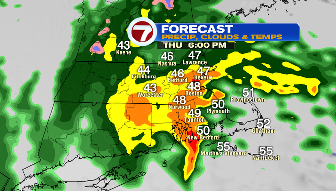
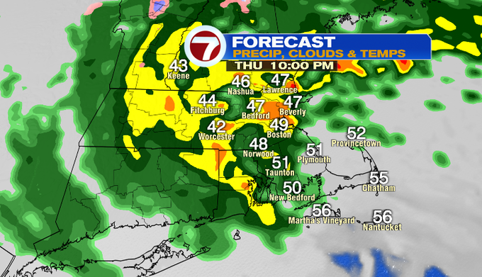
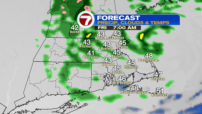
We won’t be done with the wet weather until Saturday, when there’s still a few showers leftover. We’re still expecting rainfall totals 1.5 – 3″ when all is said and done.
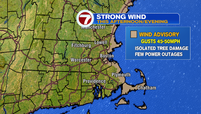
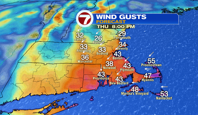
That’s the rain, but this is a nor’easter so next is the wind. There’s a Wind Advisory this evening. Gusts will be strongest on the coast up to 45-50 mph. Gusts that high could cause some tree damage and a few power outages. Gusts inland could push 30-40 mph.
Luckily, this storm is not arriving around an astronomically hide tide. We will have to watch for flooding on our east-facing coastal towns around this evening’s high tide near 8pm. That’s when we will have the strongest push of the onshore wind allowing water to pile up. We should get by with just some splashover to minor coastal flooding. That means any inundation should stay under one foot on shore roads.

So where’s the good news with the weather? Some sunshine returns on Sunday. Memorial Day looks nice with temperatures more mild next week.
-Meteorologist Melanie Black

