
It was cool and cloudy today as we backtracked on the calendar and felt more like early April. The cool temperatures and clouds stick around tomorrow as our spring nor’easter is inbound.
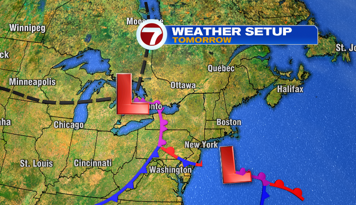
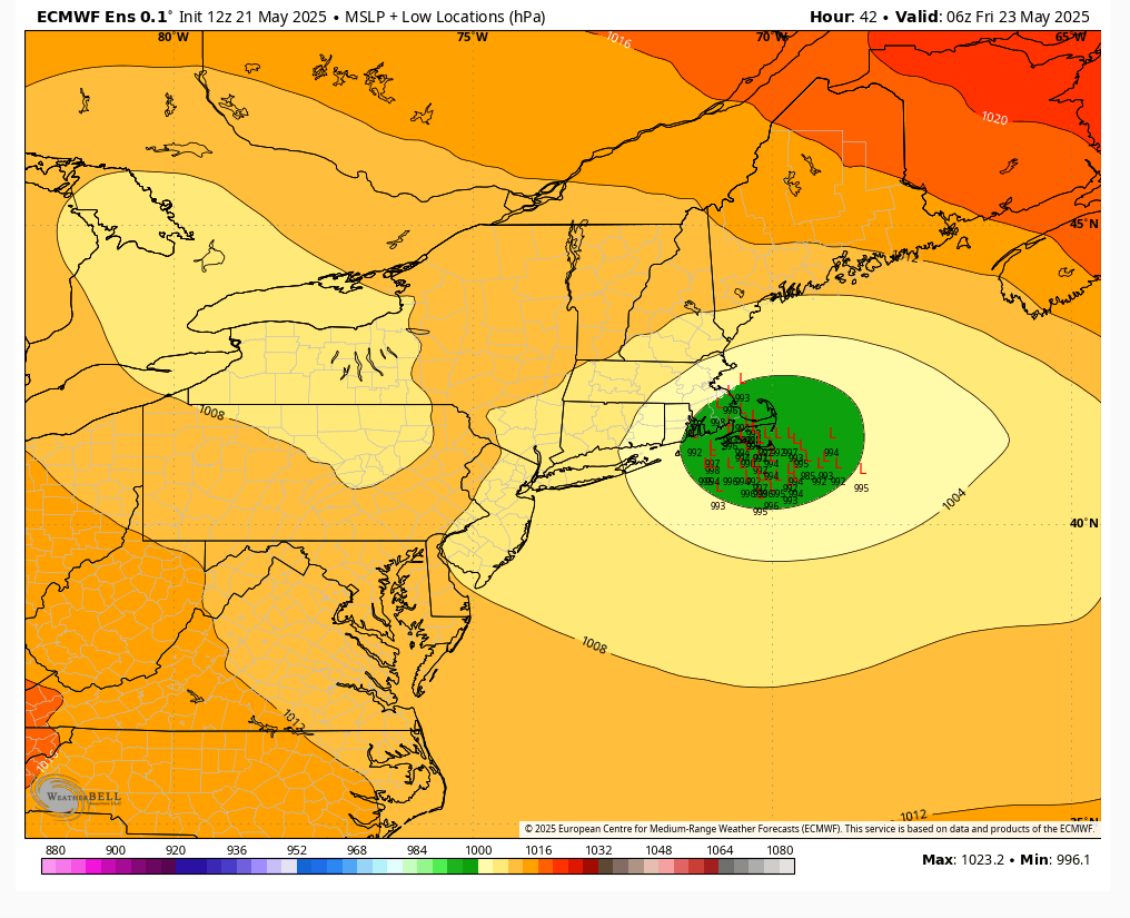
We’ve been following a storm that’s caused severe weather across the Midwest and South. Another area of low pressure develops off of that, and that’s our nor’easter. As it moves closer to us, the rain will become heavy and wind will pick up. It will likely track over southern New England or just offshore. Poor drainage flooding, a few power outages and minor coastal flooding are threats we’ll monitor from this.
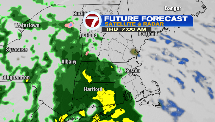
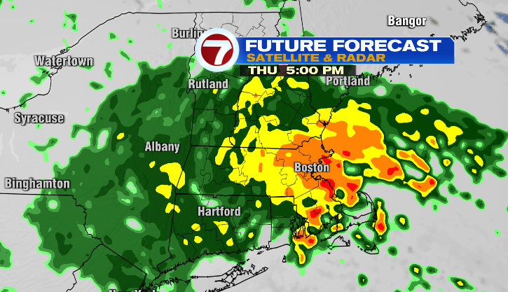
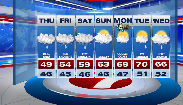
We’ll time out the rain first. Overnight, a few showers are possible. Tomorrow morning, some of us will still be dry. Rain will continue to fill in for the morning. At this point, it’s steady. By the afternoon, rain turns heavy. Downpours are likely for the evening commute. It’s a wind-driven, heavy rain, so you might want to adjust your commute hours if possible tomorrow. Rain stays heavy at times through tomorrow night. A few showers continue Friday morning.

A widespread 1.5 -2” of rain is likely through Friday morning. There could be localized higher amounts up to 3”. Expect some poor drainage flooding and ponding on the roads.

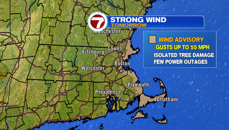
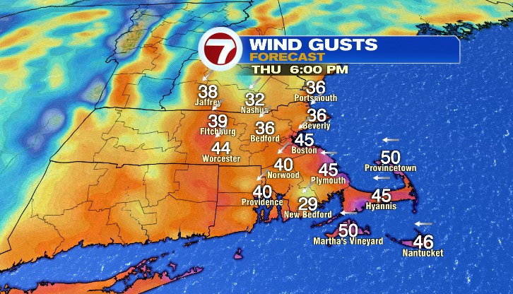
If you’re a New Englander, you know nor’easter means a strong wind is coming. The strongest wind will be tomorrow afternoon and evening. Gusts up to 50-55 mph are possible on the coast. That’s where there will be the greatest threat for downed tree limbs and a few power outages possible. I think gusts inland could still be 35-45 mph.
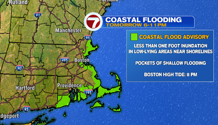
We’ll watch for minor coastal flooding, especially around tomorrow’s 8 pm high tide. The northeast wind will be the strongest during that tide. Luckily, it won’t be an astronomically high tide. Boston’s tide level is forecast to be 12 feet and minor flood stage is 12.5 feet. Plan for pockets of shallow flooding on roads that tend to flood easily with above normal tides.
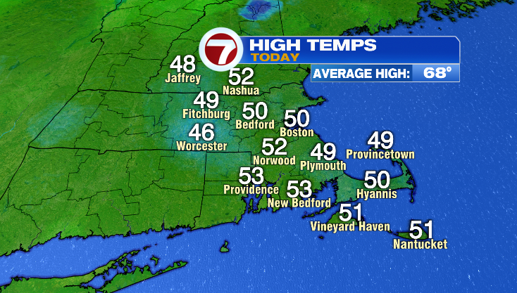
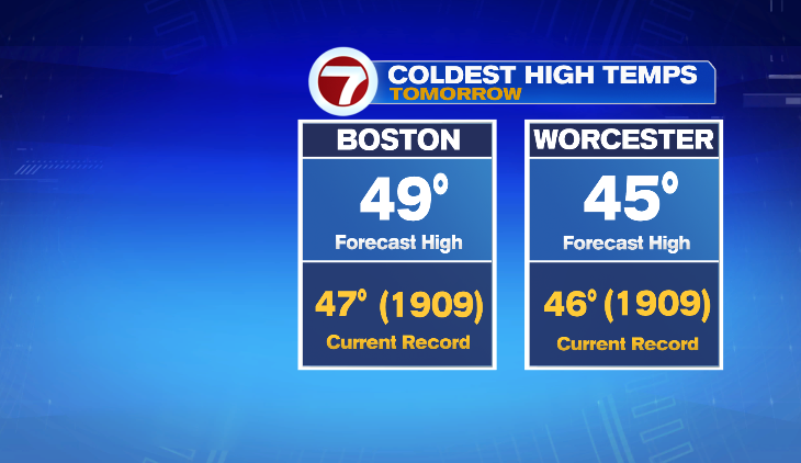
Let’s talk about temperatures. Check out those highs for today! We were stuck in the 40s and 50s. As of this writing, Boston’s high was 50 degrees. That’s 18 degrees below average!
Tomorrow’s highs will be even cooler and feel cooler with the gusty onshore wind. Temperatures won’t have a lot of forward movement. We start out in the 40s and end the day in the 40s. Those highs will be some of the coldest we’ve ever experienced on May 22nd.
We’ll stay below average through Sunday. Luckily, the sunshine makes a return appearance then too. Highs are more seasonably mild on Memorial Day.
-Meteorologist Melanie Black

