
We got a taste of summer today with highs in the 80s! Those temperatures were more than 15° above normal today. The heat peaks tomorrow with increasing humidity. Storms are in the forecast through the end of the week as well.
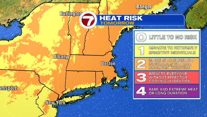
There’s a moderate risk for heat tomorrow. That means those sensitive to heat especially without proper cooling or hydration could be impacted.
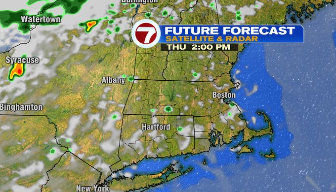
Temperatures stay mild overnight in the upper 50s/low 60s. We’ll see hazy sunshine tomorrow. That along with some very warm temperatures above us will push our temperatures near 90°. Once again the exception will be the Cape and Islands where the southwest wind will be coming off the cooler Atlantic. Temperatures will be in the 70s.

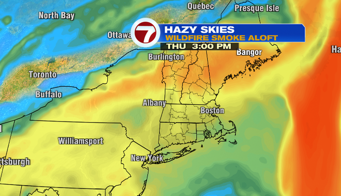
We’ve had a milky look with smoke aloft from the Canadian fires today. Some haze will still be around tomorrow. The air quality is forecast to be unhealthy for sensitive groups tomorrow due to ozone levels.
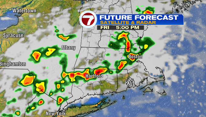
With the heat and humidity around tomorrow, a pop-up storm is possible later in the day. A front will be nearby on Friday and spark the chance for scattered storms in the afternoon and evening. Expect downpours if you get caught under a storm then.
Scattered showers will be around Saturday. The cold front slides through Saturday afternoon. That will cap temperatures and it won’t be as warm as previous days. It will also get rid of the humidity.

-Meteorologist Melanie Black

