
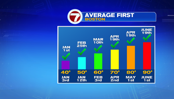
It was a hot and humid one out there today! Boston hit 90° for the first time this year. Yes, it was hot and felt even hotter with the humidity, just not as much of a scorcher as this day last year. Today’s record is 98° from 2024. Get ready, because upper 90s near 100° highs are in the forecast for next week.

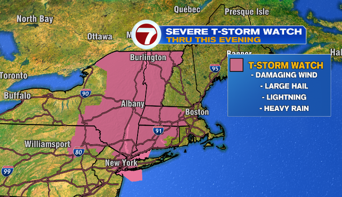
This evening, there’s a severe thunderstorm watch. That means atmospheric ingredients are there for storms to possibly turn severe. You can see the area highlighted below in pink covers western and central Mass including Worcester County. The biggest threats would be damaging straight-line winds and large hail.
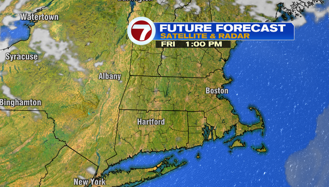
Those storms are ahead of a cold front. The cold front sweeps across Southern New England overnight through early tomorrow morning. That will drop our dew points and temperatures tomorrow. It will be warm and sunny with highs in the low/mid 80s inland and 70s for the Cape.

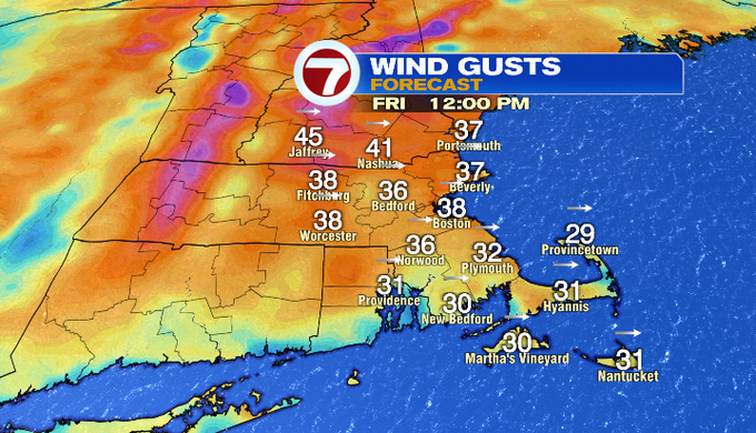
Some strong wind above us will mix down, so it will be a breezy day. West winds could gusts above 30 mph.
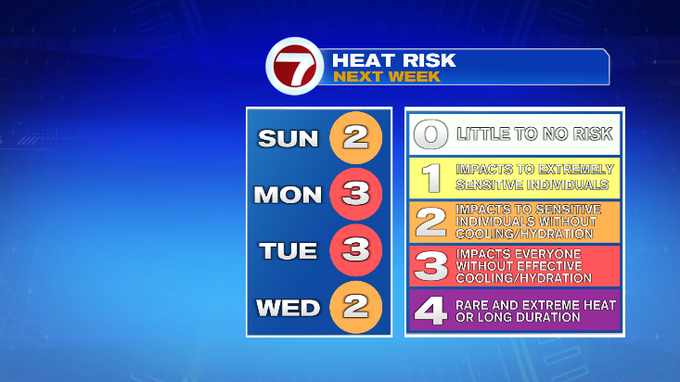
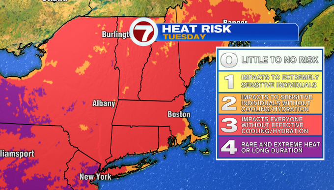
It says warm this weekend in the 80s with a chance for an isolated storm Sunday morning. Then we’ll turn our attention to extreme heat next week as a heat dome builds across the East Coast. The humidity will come along with it. The heat is expected to peak on Tuesday when temperatures could reach near 100°. Heat index values could range from 100-105°.
For now, enjoy the first day of summer tomorrow! The summer solstice occurs at 10:42 pm.
-Meteorologist Melanie Black

