
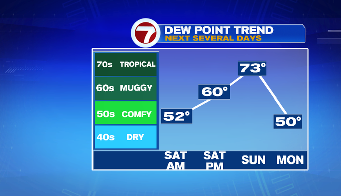
Today was what New England summer dreams are made of! It felt comfortable, and it wasn’t too warm with plenty of sunshine. More of the same is on tap for tomorrow. Sunday brings some change. The humidity returns, and there will be scattered storms.
Before we get to those storms, it’s a lovely evening! We will have mainly clear skies, light wind and dry air in place overnight. Those factors all allow temperatures to really tumble overnight. We’ll fall into the 50s and 60s. It’s a great night to open up the windows!

Tomorrow will bring plenty of sunshine. We’ll warm into the mid 80s inland. An onshore wind will keep temperatures lower on the coast in the upper 70s/low 80s.
High pressure is around tomorrow keeping us dry. There’s humidity locked to the south of a front draped through the Ohio Valley. High pressure moves out Sunday allowing a warm front to come through. Expect showers and storms Sunday morning. It will turn more humid. Then a cold front sweeps through in the afternoon and evening. Out ahead of that, there remains another chance for storms.


Models today are hinting that we could warm up pretty good on Sunday. Temperatures start out mild near 70. After the morning showers and storms, we will get into some sunshine. That will help to warm our temperatures into the upper 80s/near 90.
Temperatures drop Monday and Tuesday. Then we rebound toward the end of the week back near 90. The chance for storms return toward the end of the week.
-MB

