
Happy Tuesday! It was a damp day today, but felt pretty seasonable for much of the day. We’ll have a pretty similar day tomorrow, with a big temperature shift later on.
First, we will continue to see some rain showers, even a few more rumbles of thunder, this evening and tonight. Temperatures will come crashing down into the 40s. There will be a few more random showers around for Wednesday as well. Many of us will get warm in the early afternoon, with another temperature crash set to roll in during the late afternoon.
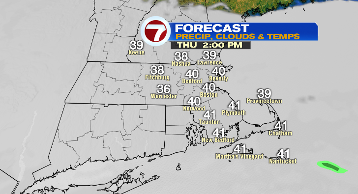
Thursday there may be some showers and drizzle around. But that’s not what you’ll notice the most. It’s going to be cold! We will spend most of the day in the 30s. That cooldown, along with the gray skies, will make for a raw day.
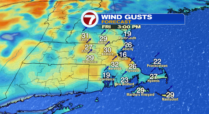
Friday starts cold in the 30s with some morning drizzle and clouds around. As the day goes on, the sun will try to break out just a little bit with warming temperatures into the upper 60s. It’ll be a bit breezy, too.
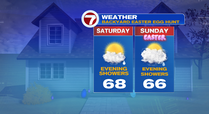
Saturday looks partly sunny and into the upper 60s after a morning starting off near 50 degrees.
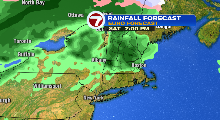
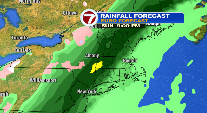
There’s a chance for some isolated showers in the evening then, too. That rain chance is higher going into Easter Sunday evening.
Much of the day looks dry, though, but cloudy with highs into the mid 60s.
Monday, expect partly sunny skies with highs near 50 degrees, and Tuesday a sun/cloud mix with highs in the upper 40s. Stay tuned!

