
Happy Monday! It’s been a beautiful start to the work week, but we have some hot temperatures to talk about this week.
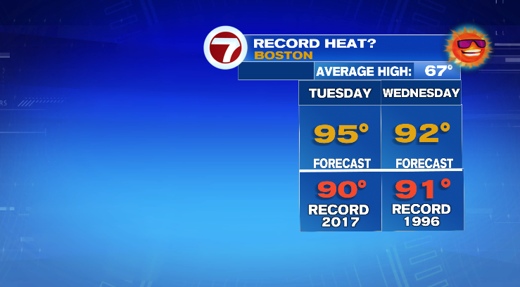
First, a sea breeze is keeping temperatures out there now widely variable, anywhere from the 50s to the 80s. We’ll at least all be dry for the rest of tonight. Tomorrow we’ll wake up in the 60s with scorching high temperatures topping off in the mid 90s.
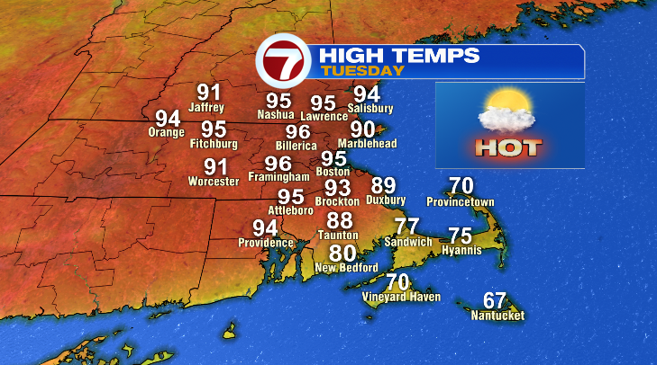
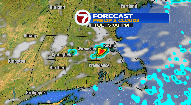
It’ll be hot and breezy Tuesday but we also have a low-end chance for an isolated storm in the afternoon or evening.
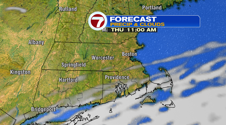
Wednesday will feature another chance for showers and thunderstorms, but this time that chance is pretty likely in the afternoon and evening. In fact, some of these storms could become strong to severe with gusty winds and hail.
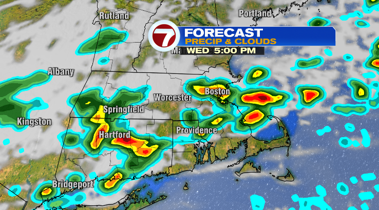
Thunderstorm development will be supported by the heat and humidity we’re expecting on Wednesday. Highs will once again reach the 90s.
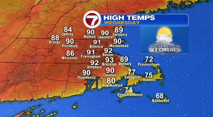
These temperatures are rivaling records for this time of year.
The humidity will only work to make it feel even hotter than it really is, with dew points forecast to be sticky in the 60s.
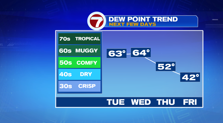
If you’re not quite ready for the summer-like weather, you don’t have to wait too long. Thursday’s lows are in the 50s with highs in the upper 60s. Friday morning we’ll get all the way down to the 40s before only reaching the upper 60s. At least both days will be bright!
Memorial Day weekend is from Saturday through Monday, and I wish I had better news. We’re tracking chilly highs in the upper 50s and low 60s with chances for rain. Stay tuned!

