Happy Tuesday! It’s been a windy one so far today. Your Wednesday is looking pretty windy, too, and a little bit cooler. Many of us will be on the cloudy side, with more sunshine as you head farther north and west well away from 495.
First, evening temperatures will drop from the 50s to the 40s. Some of us will be cloudier than others overnight, and where the clouds linger the temperatures will be more mild:
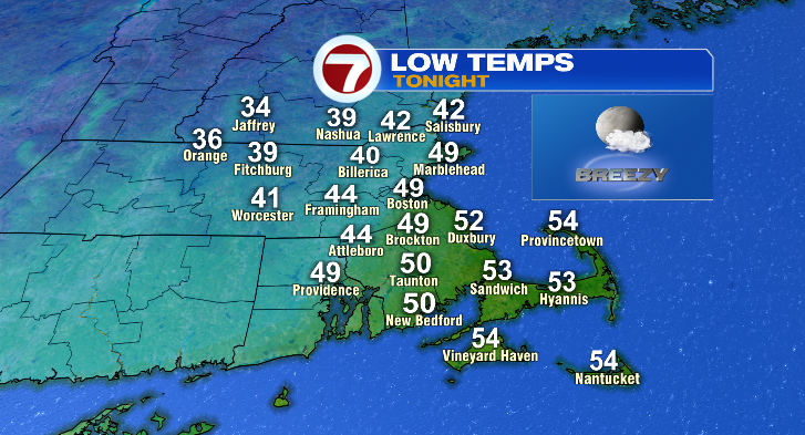
Where it’s more clear overnight, you’ll drop to the 30s like across southwestern New Hampshire and north central Massachusetts.
Wednesday, the clouds will build in especially east. Highs will be on the cool side in the low to mid 50s. Where there’s more sunshine across southwestern New Hampshire and north central Massachusetts, you’ll get up to the mid to upper 50s. Still, that’s pretty cool. Winds will be gusting near 30 mph, and get ready for that to make it feel even cooler!
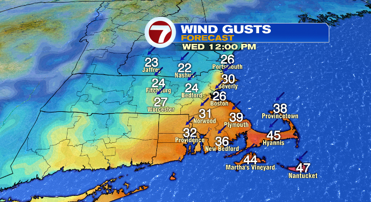
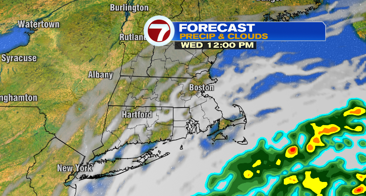
We’re also watching some rain chances late in the day and overnight into Thursday morning across southeastern Massachusetts, especially farther on the Cape and the islands.
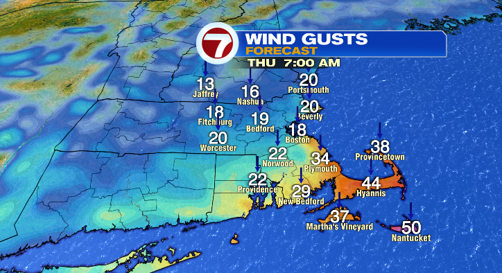
Thursday morning, we’ll get down to the upper 30s and low 40s (staying in the mid to upper 40s on the Cape) with highs up to the upper 50s and low 60s. Clouds will be around again, and it’ll be downright windy.
Friday the wind starts to diminish greatly! It may be slightly breezy at times, but nothing like midweek. We’ll get down to the 30s in the morning with afternoon highs in the low 50s with bright, sunny skies.
This weekend, the sun will be out BOTH days! Both days start in the 30s with highs in the upper 50s Saturday and in the low to mid 60s Sunday. Monday gets warm! The morning starts in the low to mid 40s with highs in the upper 60s! That’ll feel incredible with the sun. Tuesday morning’s lows will be in the 40s with cooler highs back down to the upper 50s with partly sunny skies. Stay tuned!