
While our afternoon highs this week are heating up, get ready to still see more cooler mornings and nights.
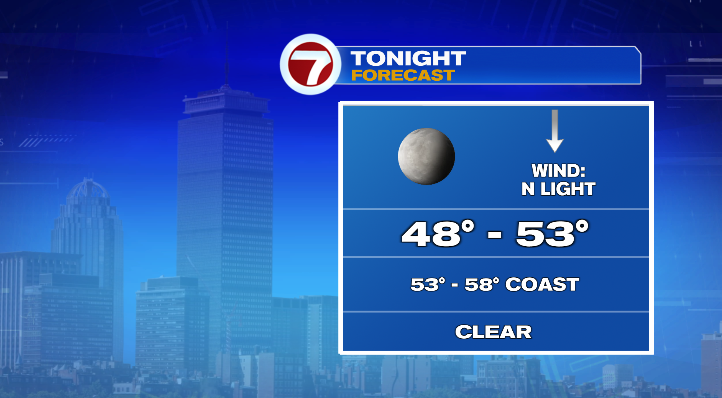
For the rest of your Tuesday evening, temperatures will rapidly cool from the 70s to the 60s. Overnight, farther inland we’ll see the upper 40s and low 50s for lows. However, coastal areas will only dip down to the mid to upper 50s. Skies will be clear and winds light.
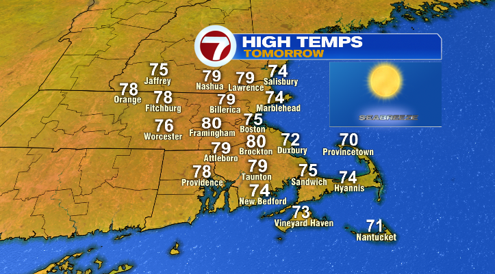
Highs for your Wednesday depend on where you’ll be. Inland, most will reach the upper 70s while at the coast, only the low to mid 70s.
Otherwise, skies will remain bright. Thursday, highs will reach the upper 70s and low 80s. Again, the coast will be cooler in the mid to upper 70s.

Friday is the only day we have a chance for rain, and that chance right now is less than 20 percent. That’s just a low-end chance for an isolated shower; and we definitely need more rain than that. Otherwise, we’ll be mostly sunny with highs in the low 80s. At the coast, highs will be closer to the mid to upper 70s.
This weekend: mostly sunny skies and highs inland in the low 80s. At the coast, beaches, and the Cape and the islands: mid to upper 70s. Monday will be similar. Skies partly sunny, highs in the low 80s with coastal areas in the mid to upper 70s. Tuesday will be dry and partly sunny again with highs in the upper 70s and low 80s.

