
While Monday was a damp, drizzly day across Massachusetts, we dried out Tuesday and we’ll stay that way into the foreseeable future.
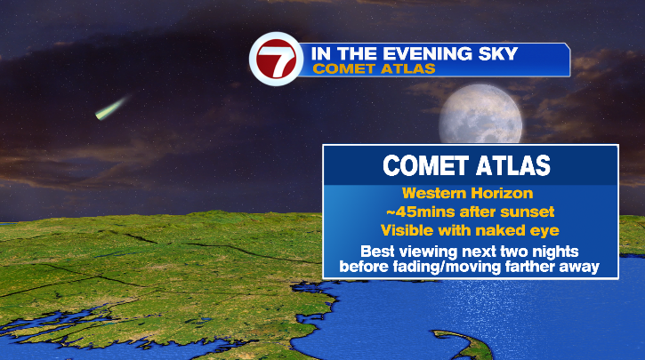
Overnight, sky conditions will be great to get a chance to look at the Comet Atlas. Skies will be mostly clear, and you can look at the western horizon after 45 minutes after sunset.
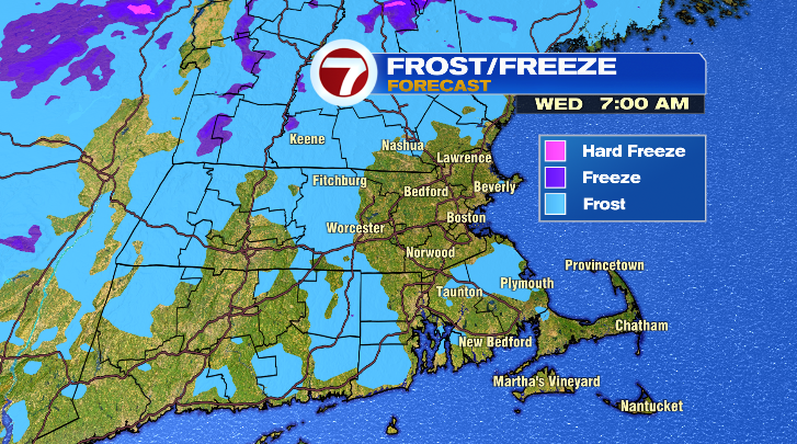
Get ready for another chilly start to Wednesday. Away from the coast, morning lows will drop to the mid to upper 30s again. Near the water, lows will drop closer to the 40s. Still a chilly start for all, especially with a light breeze in the air.
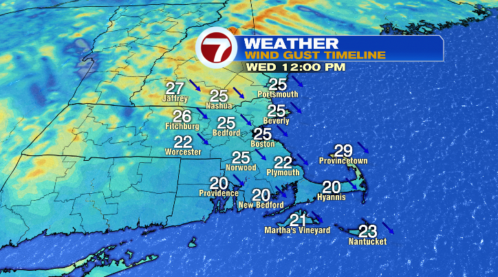
The wind will only grow stronger into the afternoon, which will make the highs near 52-57 degrees to feel closer to the upper 40s and low 50s. The rest of the day we’ll be dry and partly sunny.
Thursday morning will be the coldest this week. Away from the water, lows will be downright cold in the upper 20s and low 30s.
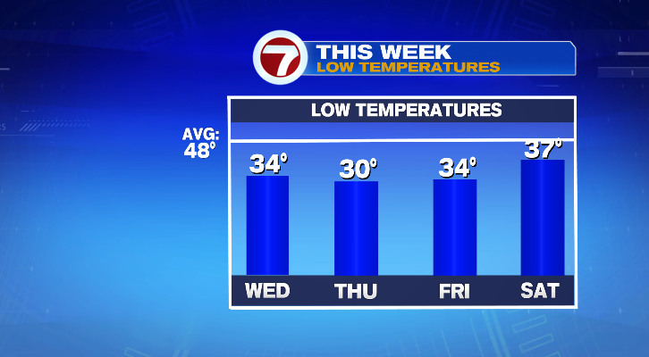
Across the coast and the Cape, though, again only the 40s. We’ll be mostly sunny Thursday with highs in the mid to upper 50s, which is still pretty cool compared to average for this time of year. The dry streak continues into Friday with sunny skies. We’ll start Friday morning in the low to mid 30s away from the coast, and the 40s along the coast, the Cape and southeastern Massachusetts.
This weekend looks picture-perfect, although the mornings will still be on the chilly side.

Saturday and Sunday morning will still be cold in the upper 30s but a wind shift and ample sun will actually warm us way up into the upper 60s and even low 70s in spots.
Monday morning we’ll finally break away from the bitter-cold mornings. It’ll still be chilly in the upper 30s and low 40s. Mostly sunny skies will help a warm-up to the low 70s. Tuesday morning will be even less cold in the mid to upper 40s. Mostly sunny skies will be here to stay with very warm highs in the low to mid 70s.

