
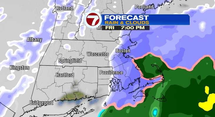
Be careful for the evening commute this Friday, especially areas farther east where over 3 inches of snow could accumulate.
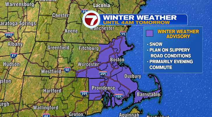
While central Massachusetts will dry out earlier in the evening, it’ll take areas farther east like the Cape longer to dry out, closer to 11 p.m. and midnight tonight.
Overnight, temperatures will fall! We’ll be waking up to temperatures in the low 20s for Saturday with highs in the low to mid 30s. There will be more clouds than sun, and we can’t rule out a spotty flurry.
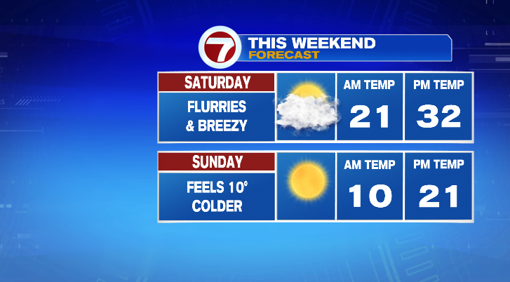
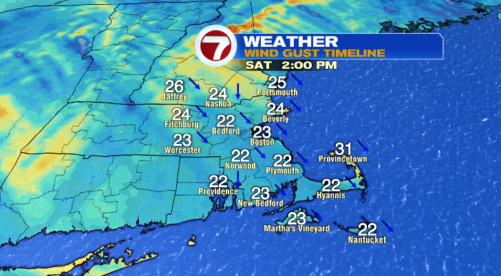
Winds will gust to 20 to 25 mph, so that’ll make it feel like the mid to upper 20s during the warmest part of the day Saturday.
The real frigid air comes on Sunday. A massive dip in the jet stream will surge arctic air into New England, sending temperatures tumbling. Lows Sunday morning will get down to the single digits with highs only in the low 20s. Some spots of north central Massachusetts and southwestern New Hampshire will struggle to make it out of the teens. At least skies will be bright.
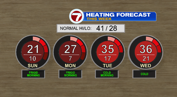
Monday will be another frigid yet sunny day. Morning temperatures will drop a few more degrees than Sunday with highs in the mid to upper 20s.
Tuesday is Christmas Eve, and we’ve got a chance for a couple of snow showers! Highs will be back to the 30s. Christmas Day, most look dry right now with highs in the 30s. However, we are watching the potential for some rain showers near the Cape. Thursday and Friday will be more mild near 40 degrees and dry.
Happy Holidays!

