
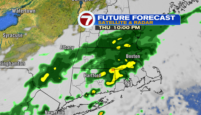
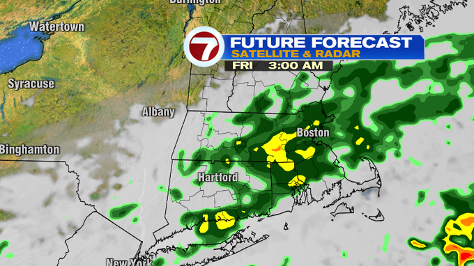
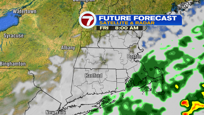
We’re ending the month of July on a wet note. A slow-moving front will continue to promote rain showers through tomorrow morning. Heavy rain and downpours will continue this evening as the main slug of moisture slides southeast. Expect rain through this evening generally along and north of the Mass Pike. If you’re in far southeast Mass, you’ll likely avoid heavy rain until tomorrow morning. However, any showers will linger through the morning for you, especially if you’re on the Cape and Islands. Clouds will be slow to clear tomorrow, but then we’ll get into some sunshine before the day is over.

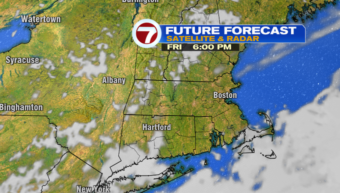
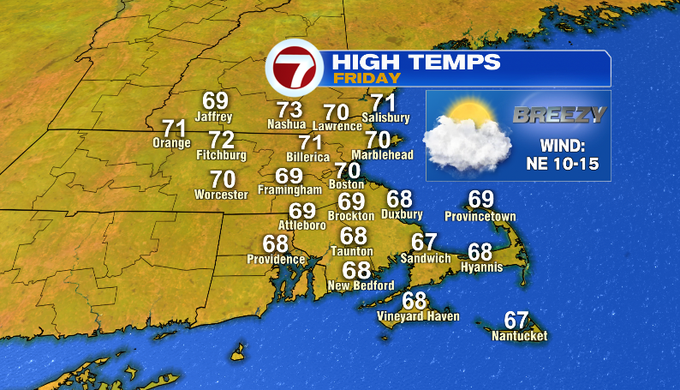
Tomorrow, temperatures start out in the upper 50s/low 60s and will not climb that high. There will be areas of fog tomorrow morning. Clouds will be slow to clear through the day. Clouds and a persistent breeze out of the northeast will keep temperatures in the upper 60s/low 70s. That’s more than ten degrees below average for the first day of August.
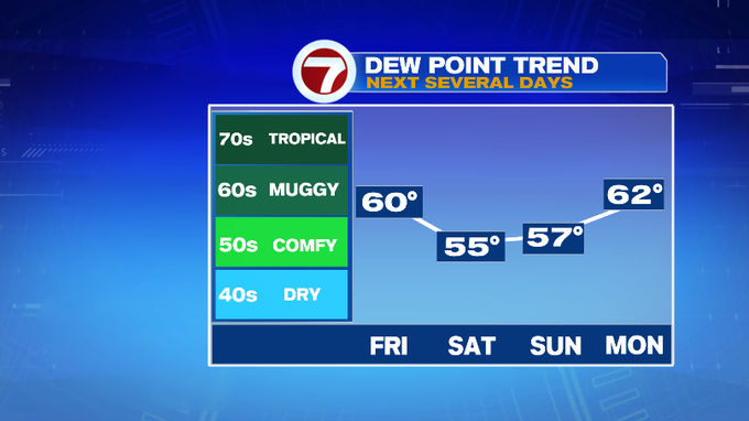
Drier air will continue to work in by Saturday. Dew points will be in the comfy range for the weekend.
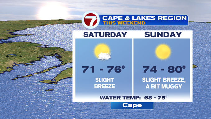
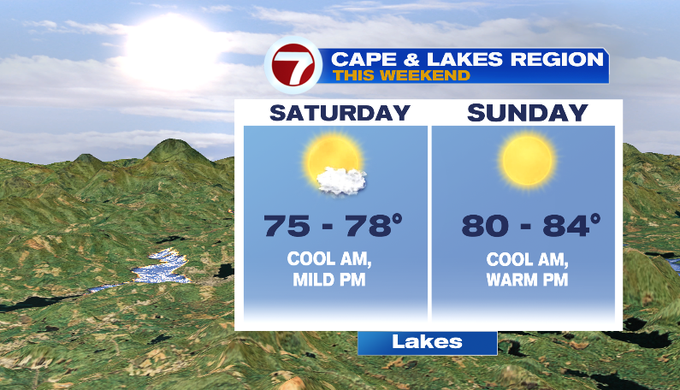
It will be a beautiful first weekend of August around New England with low humidity and plenty of sunshine! Temperatures will mainly be in the 70s both weekend days for the Cape thanks to an onshore breeze. Heading to the lakes? Temperatures will be mild Saturday and slightly warmer on Sunday.
Rain and storm chances stay away until the middle of next week.
-Meteorologist Melanie Black

