
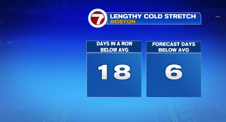
We’re keeping the tally rolling today– 18 straight days, now, of below-average high temperatures. Similarly to Wednesday, highs were in the upper 20s and low 30s, keeping the streak alive. But if you think this is cold, just wait until the weekend!
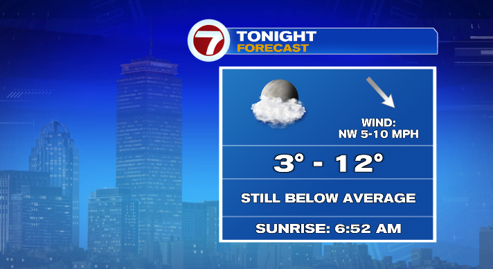
Let’s go chronologically. Tonight, we’ll have lows between about 3 – 12 degrees as well as a light breeze out of the northwest. Clouds will increase as well, especially after midnight and into Friday morning. That trend continues throughout the day Friday, with the sky becoming mostly cloudy by Friday afternoon. We could see a few flurries Friday as well. Highs will be in the upper 20s on Friday afternoon, then back into the teens Friday night.
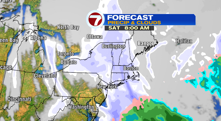
Our next storm arrives Friday night as well. It’s a quick-moving arctic front that will spur on the next round of snow here in New England. It won’t be a massive snow machine, but still something to note if you have plans Saturday afternoon. Right now, it looks like snow showers begin early Saturday morning, continuing on and off through the afternoon.
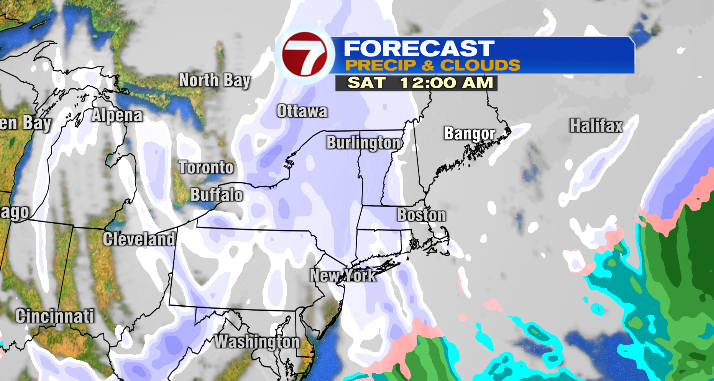
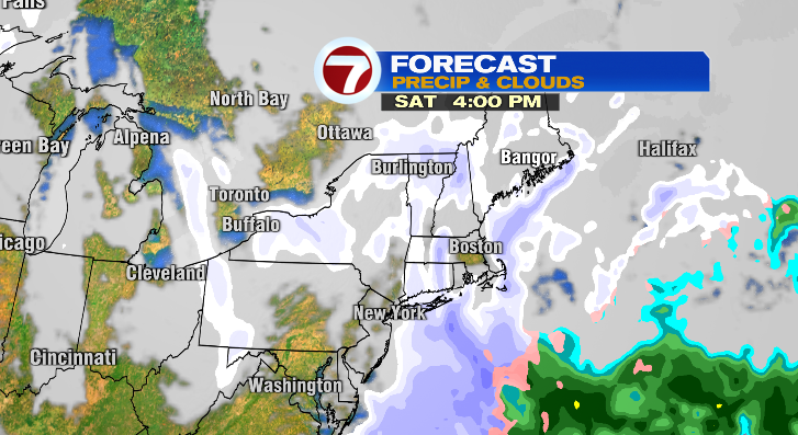
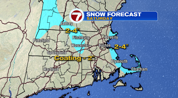
Most of Massachusetts will be in the range of a coating to 2″ of snow, though with some ocean-effect enhancement, we may see the coast end up with 2-4″ of snow by the time the storm is out of our hair Saturday evening. The Berkshires and Worcester Hills look like they’ll be in the 2-4″ range as well. Additionally, Saturday will get increasingly windy, with gusts getting into the 20s and 30s by the late afternoon.
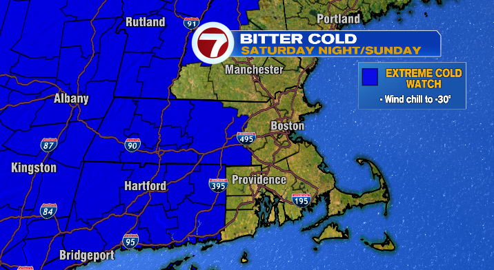
The biggest weekend impacts, however, begin as the snow comes to an end. Arctic air slides into New England after the passage of the arctic front. Expect temperatures to go down while wind gusts go up, resulting in a brutally cold Sunday morning. Wind chills will be between -10 and -20, with some isolated spots (especially higher elevations) having the potential to see -30. Sunday morning. Air temperatures will be between -2 and 5 degrees. Yikes! Even Sunday afternoon will be brutally cold, with highs only in the mid to upper teens, while feels like temperatures will stay below zero.
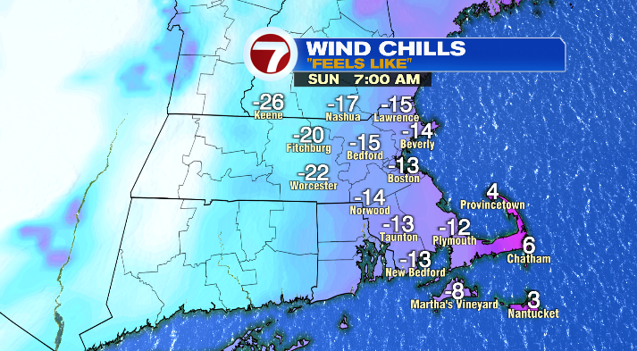
With this bitter cold on the way, the NWS has issued an Extreme Cold Watch for central and western Massachusetts from Saturday night through Sunday afternoon.
Keep that in mind if you’re heading to a Super Bowl party– you’ll want to dress warmly, even if it’s just for the walk from the car to your destination of choice! After midnight, it’ll feel like we’re double-digits below zero once again.
Next week, the trend changes. However, it’s a slow and steady process. The cold hangs on Monday– it’ll be mostly sunny and bright, but cold with highs in the low 20s. Temperatures rebound a bit by Tuesday, with highs right around 30 degrees. By the end of the week, it looks like we’ll finally be back in the mid to upper 30s– at, or even above average!
