
Happy Sunday! We hope you had a great weekend. The workweek will get off to a tough start with frigid cold, but the rest of the week we’ll warm right back up!
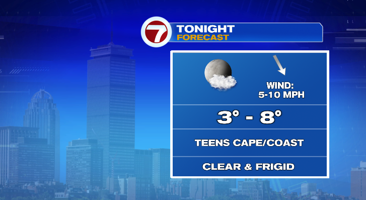
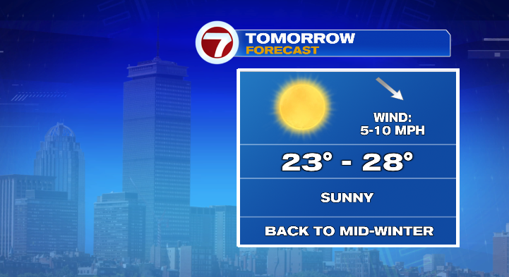
Overnight into Monday morning, prepare for lows to drop down into the single digits. Even with just your standard 5-10 mph winds, that’ll still feel like it’s a few degrees below zero in the morning. Make sure to bundle up! While the sun will be out, it won’t help us warm up much. Highs Monday will only reach the 20s.
Tuesday morning will start off frigid again. Lows will drop to the teens but at least we’ll warm in the afternoon! We’ll get close to 40 degrees. Clouds will rise in the morning and we are tracking a chance for some rain in the afternoon and evening. It may briefly start as snow or a mix north and west of the 495 corridor, but this will primarily be a rain event.
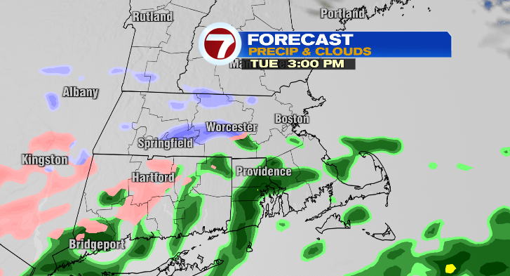
Showers will start spotty but there will be widespread rain overnight.
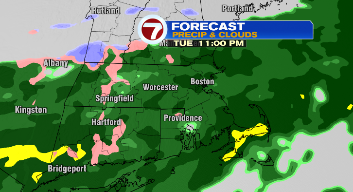
For northern Mass and southern New Hampshire, it may briefly switch back from rain to snow or a mix in the early morning hours of Wednesday before we dry out completely by about 6-7 a.m.
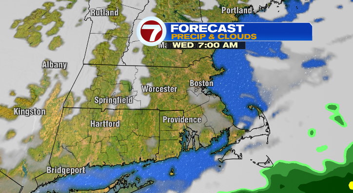
Wednesday morning we start off in the low 30s but get close to the 50-degree mark in the afternoon! The sun will be out a bit, too.
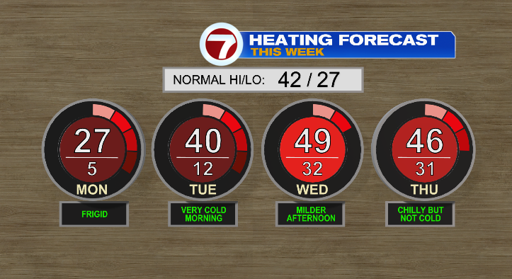
Thursday: low 30s to mid 40s with chances for a few rain showers. Friday, low 30s to low 40s with a chance for rain and/or a wintry mix. Saturday is looking quiet in the 50s with more chances for showers Sunday. Stay tuned!
