
So… we didn’t end the week in the 70s. That much is obvious. But it really was an overall seasonable day! This time of year, temperatures are normally in the low to mid 40s in the afternoon, so while we may have stayed largely below average, it was only by a degree or two.
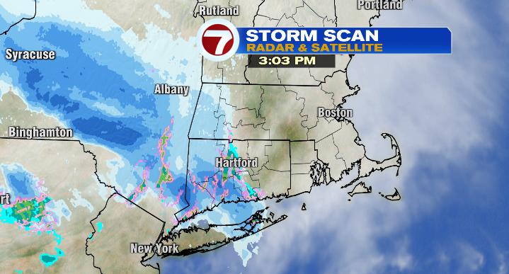
That said, you can already feel (and see) the change in the air as we look ahead to what’s next. There are more clouds around, and cloud cover will continue to increase into the evening. A quick-hitting clipper system will slide largely to our north, but it’s just close enough that, along with the clouds, we can expect an evening snow shower or two (especially north of route 2), as well as a few scattered rain and snow showers overnight. Temperatures will be in the upper 20s and low 30s.
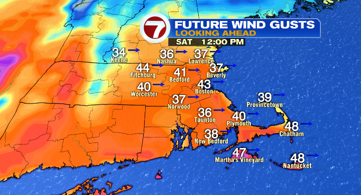
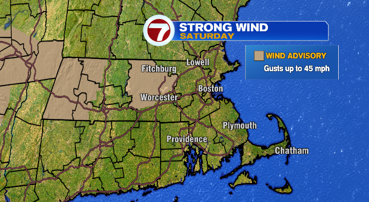
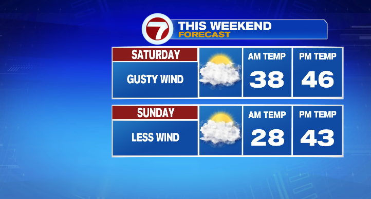
Clouds start clearing Saturday morning, and we’ll have a mix of sun & clouds during the day along with highs in the mid 40s. The most impactful part of the forecast Saturday will be some very gusty winds! Wind gusts will be in the 20s & 30s, with a few around 40mph possible! In fact, we have a Wind Advisory in place for the Worcester Hills from 10 AM – 7 PM Saturday with gusts of up to 45 mph possible.
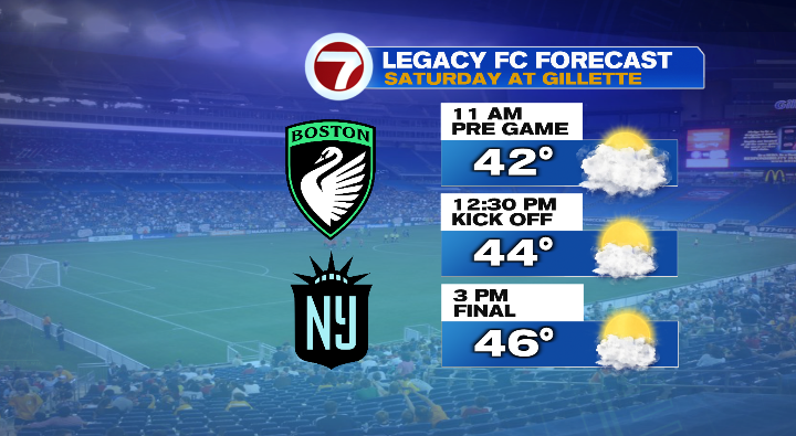
Though the actual air temperatures will be right on the money for this time of year, keep the wind in mind and add a layer when you’re getting dressed to be out and about– an important note if you’re heading to Gillette for the Boston Legacy’s inaugural game against Gotham FC! When fan fest starts at 10 AM, you can expect temperatures to be in the upper 30s/low 40s. We’ll be in the low to mid 40s for kickoff at 12:30, and in the mid 40s as the game wraps up around 3.
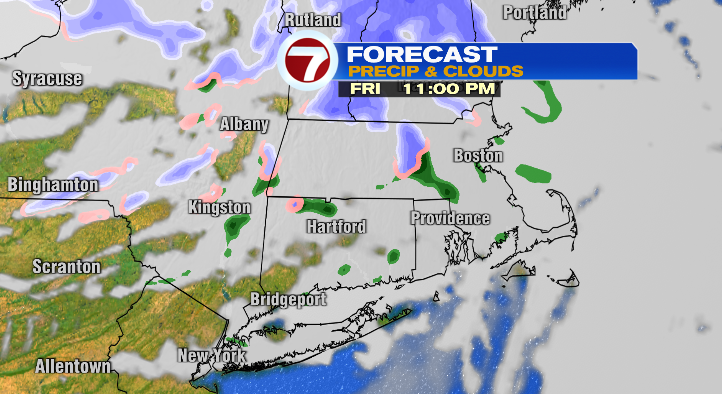
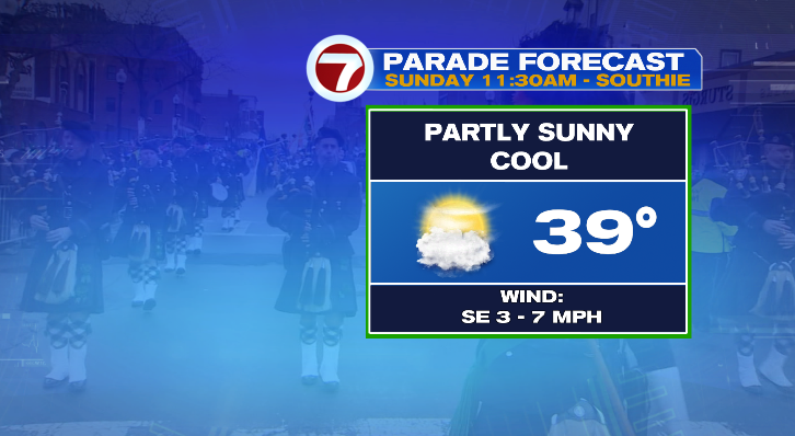
The wind will keep up through the evening, finally dying down overnight. Lows will be in the mid 20s by the time we wake up on Sunday morning. Sunday will start with sunshine, though clouds will increase throughout the day. Expect highs between about 38 – 45 degrees. Overall, it’s a cool day, but a quiet one! Bundle up if you’re heading to Southie for the St. Patrick’s Day Parade — temperatures will be in the upper 30s at the start of the parade, and in the low 40s by the end! The parade (and any other Sunday afternoon events) will stay dry though!
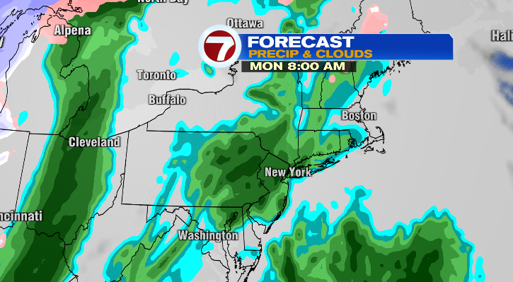
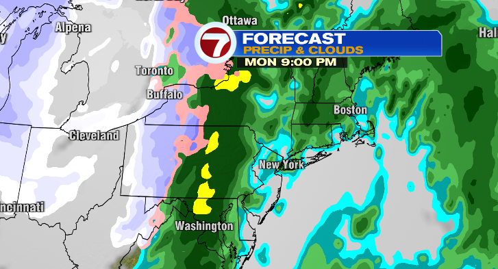
Our next storm arrives Monday morning, alongside some serious warmth. Highs will be in the mid and upper 50s, but rain starts early Monday morning and will continue on and off throughout the day. Right now, it looks like we’ll wind up with somewhere between .75 – 1.25″ of rain.
Tuesday morning (St. Patrick’s Day) starts out with an early leftover shower or two and a mostly cloudy sky. However, as clouds decrease throughout the day, wind gusts increase. We’ll be mostly sunny by the afternoon, with gusts in the 20s and 30s, and temperatures in the mid 40s.
