Happy Sunday! It was another beautiful day! Sure, it was slightly more sticky than yesterday, but overall a great day. Overnight we’ll have some changes before a quieter work week ahead.
First, your Sunday evening will be quiet. I can’t rule out a sprinkle, but otherwise just cloudy and warm with temperatures in the 70s and 60s. The breeze will linger and pick up ahead of overnight thunderstorms.
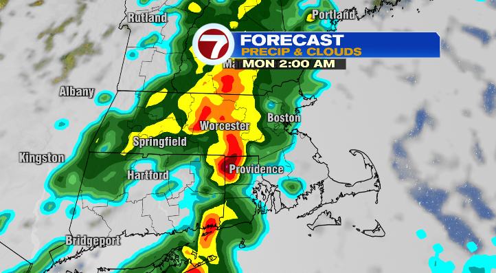
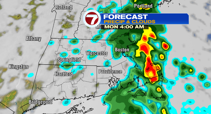
Chances begin as early as 11 p.m./midnight for central Massachusetts but it takes until 1-3 a.m. to begin for eastern Massachusetts. The storms should be out of here by 5 a.m. Monday.
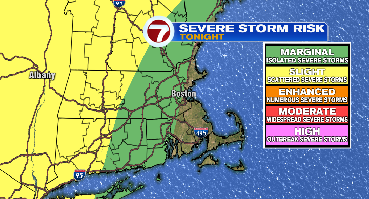
The threat for severe thunderstorms with damaging wind gusts is highest farther west, but still, there could be some isolated locations that see severe-strength storms overnight.
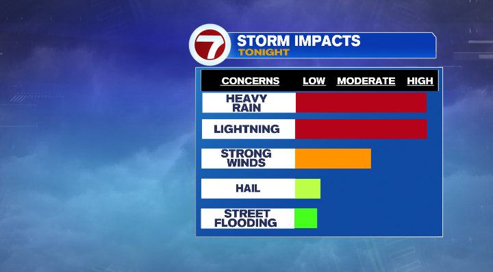
The primary threats are heavy rain, lightning and those isolated damaging wind gusts.
Since the storms exit before we need to be out of bed in the morning, Monday overall is actually going to be pretty nice! The storms will work to cool us off and eventually drop off our humidity, too. The dew point will drop as Monday progresses with partly sunny skies and warm highs in the low 80s.
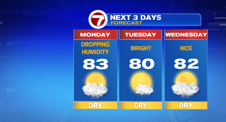
Tuesday: bright and near 80 degrees. Wednesday the nice weather continues with a partly sunny day and highs in the low 80s still. Our next threat for some scattered showers, and maybe some storms too, comes on Thursday. Highs will still be warm in the low 80s.
A warm-up to the upper 80s is ahead Friday with a low-end chance for a spot shower. Next weekend looks dry in the upper 70s and low 80s. Enjoy the week!